
Segno地形图
点击地图以显示海拔。
关于这张地图
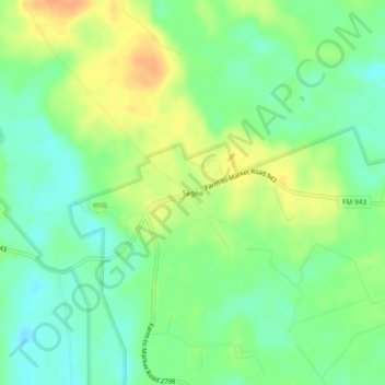
名称:Segno地形图、海拔、地势。
地点:Segno, Polk County, Texas, United States (30.55715 -94.70632 30.59715 -94.66632)
平均海拔:60 米
最低海拔:43 米
最高海拔:81 米
其他地形图
点击地图以查看其地形、其海拔和其地势。
Onalaska
United States > Texas > Polk County
The city's terrain is characterized by gently rolling hills and piney woods typical of the East Texas Timberlands region. Elevations within Onalaska range from approximately 128 feet (39 m) to 253 feet (77 m) above sea level, with an average elevation around 161 feet (49 m).
平均海拔:49 米
Lake Livingston
United States > Texas > Polk County
The earthfill dam has a concrete spillway and was designed by Brown and Root, Incorporated (now KBR, Inc). The dam has a spillway crest elevation of 99 feet (30 m) above mean sea level. The average base width of the dam's earthen embankment is 310 feet (94 m) wide. The spillway is designed and constructed to…
平均海拔:66 米