
Beaverton地形图
点击地图以显示海拔。
关于这张地图
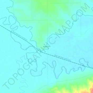
名称:Beaverton地形图、海拔、地势。
地点:Beaverton, Valley County, Montana, United States (48.40599 -107.27838 48.44599 -107.23838)
平均海拔:669 米
最低海拔:657 米
最高海拔:743 米
其他地形图
点击地图以查看其地形、其海拔和其地势。
Glasgow
United States > Montana > Valley County
According to the United States Census Bureau, the city has a total area of 1.43 square miles (3.7 km2), all land. The town has an elevation of 2,093 feet (638 m). It is nestled in the Milk River Valley with the river itself meandering along to south.
平均海拔:654 米