Westport地形图
点击地图以显示海拔。
关于这张地图
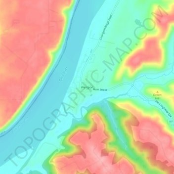
名称:Westport地形图、海拔、地势。
地点:Westport, Oldham County, Kentucky, 40077, United States (38.45895 -85.49496 38.49895 -85.45496)
平均海拔:178 米
最低海拔:127 米
最高海拔:242 米
其他地形图
点击地图以查看其地形、其海拔和其地势。

点击地图以显示海拔。
名称:Westport地形图、海拔、地势。
地点:Westport, Oldham County, Kentucky, 40077, United States (38.45895 -85.49496 38.49895 -85.45496)
平均海拔:178 米
最低海拔:127 米
最高海拔:242 米
点击地图以查看其地形、其海拔和其地势。