
Monviso地形图
点击地图以显示海拔。
Monviso
Monte Viso is the location of a Neolithic jadeite quarry, at an elevation of 2,000 to 2,400 metres. Its productivity peaked around 5000 BC. The jadeite was used to make cult axes, which are found all over western Europe. One such ceremonial axe head was found as far away as a small hill called Tristia in Western Ireland and is on display in the National Museum of Ireland – Archaeology, Dublin.
关于这张地图
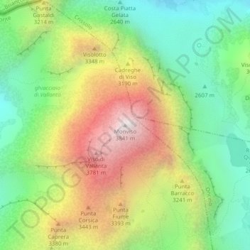
名称:Monviso地形图、海拔、地势。
地点:Monviso, Pontechianale, Cuneo, Piedmont, Italy (44.66739 7.08994 44.66749 7.09004)
平均海拔:2,985 米
最低海拔:2,385 米
最高海拔:3,831 米