
Fort Scott地形图
点击地图以显示海拔。
Fort Scott
Fort Scott is located at 37°50′7″N 94°42′7″W / 37.83528°N 94.70194°W / 37.83528; -94.70194 (37.835180, −94.702015) at an elevation of 846 feet (258 m). It lies on the Osage Plains on the south side of the Marmaton River. Located at the intersection of U.S. Routes 54 and 69 in southeast Kansas, Fort Scott is approximately 54 miles (87 km) north of Joplin, Missouri, 92 miles (148 km) south of Kansas City, and 143 miles (230 km) east of Wichita.
关于这张地图
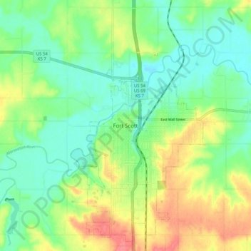
名称:Fort Scott地形图、海拔、地势。
地点:Fort Scott, Bourbon County, Kansas, 66701, United States (37.79998 -94.74829 37.87998 -94.66829)
平均海拔:260 米
最低海拔:235 米
最高海拔:303 米