
Cumberland Shores地形图
点击地图以显示海拔。
关于这张地图
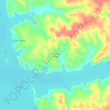
名称:Cumberland Shores地形图、海拔、地势。
地点:Cumberland Shores, Trigg County, Kentucky, United States (36.73227 -87.96780 36.77227 -87.92780)
平均海拔:131 米
最低海拔:104 米
最高海拔:181 米
其他地形图
点击地图以查看其地形、其海拔和其地势。
Land Between the Lakes National Recreation Area
United States > Kentucky > Trigg County
The United States Army Corps of Engineers constructed a dam on the Cumberland, producing another lake. It was planned to be at the same elevation as Kentucky Lake, and the two rivers were to be connected by a canal that did not require locks. This project was intended to lessen the shipping distances for goods…
平均海拔:146 米