
Macabebe地形图
点击地图以显示海拔。
关于这张地图
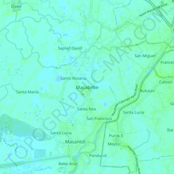
名称:Macabebe地形图、海拔、地势。
地点:Macabebe, Pampanga, Central Luzon, 2018, Philippines (14.86961 120.67552 14.94961 120.75552)
平均海拔:3 米
最低海拔:-2 米
最高海拔:7 米
其他地形图
点击地图以查看其地形、其海拔和其地势。
Angeles
Sapangbato is the largest barangay in Angeles in terms of territory, with a total land area of 104,694 sq. meters and a population of 11,262. Located northwest of Angeles near Clark Freeport Zone, it is identified as the barangay in Angeles with the highest elevation of 750 feet above sea level. It is home to…
平均海拔:98 米