
Interlochen地形图
点击地图以显示海拔。
关于这张地图
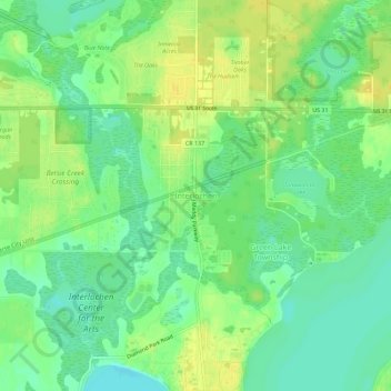
名称:Interlochen地形图、海拔、地势。
平均海拔:258 米
最低海拔:247 米
最高海拔:268 米
其他地形图
点击地图以查看其地形、其海拔和其地势。
Traverse City
United States > Michigan > Grand Traverse County
The locale and topography is conducive for road bicycling, aided by the TART trail system. A map with routes, different trips, advice and local knowledge is available. Lake Michigan presents a location for sailing, fishing, and kayaking.
平均海拔:204 米