West Mound地形图
点击地图以显示海拔。
关于这张地图
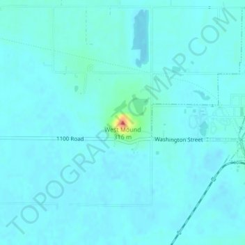
名称:West Mound地形图、海拔、地势。
地点:West Mound, Wilson County, Kansas, 66736, United States (37.53194 -95.85114 37.53204 -95.85104)
平均海拔:263 米
最低海拔:257 米
最高海拔:315 米
其他地形图
点击地图以查看其地形、其海拔和其地势。

点击地图以显示海拔。
名称:West Mound地形图、海拔、地势。
地点:West Mound, Wilson County, Kansas, 66736, United States (37.53194 -95.85114 37.53204 -95.85104)
平均海拔:263 米
最低海拔:257 米
最高海拔:315 米
点击地图以查看其地形、其海拔和其地势。