
Long Pond地形图
点击地图以显示海拔。
Long Pond
Long Pond is named after the wetland topography formed by Tunkhannock Creek. Within the Long Pond community are public access lands, containing many species of plants and animals. Long Pond has been called "the most unique inland freshwater wetland in the state".
关于这张地图
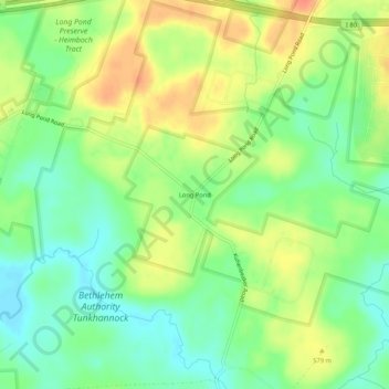
名称:Long Pond地形图、海拔、地势。
平均海拔:571 米
最低海拔:550 米
最高海拔:596 米
其他地形图
点击地图以查看其地形、其海拔和其地势。