
Conception地形图
点击地图以显示海拔。
关于这张地图
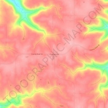
名称:Conception地形图、海拔、地势。
地点:Conception, Wabasha County, Minnesota, United States (44.24552 -92.12989 44.28552 -92.08989)
平均海拔:338 米
最低海拔:235 米
最高海拔:366 米
其他地形图
点击地图以查看其地形、其海拔和其地势。
Plainview
United States > Minnesota > Wabasha County
Plainview was platted in 1857. The city was named from its location on a plain at a lofty elevation, where a "plain view" can be had of the surrounding area. A post office has been in operation at Plainview since 1857. Plainview was incorporated in 1875.
平均海拔:348 米