
Muyombe地形图
点击地图以显示海拔。
关于这张地图
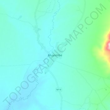
名称:Muyombe地形图、海拔、地势。
地点:Muyombe, Mafinga District, Muchinga Province, Zambia (-10.61253 33.41361 -10.53253 33.49361)
平均海拔:1,238 米
最低海拔:1,180 米
最高海拔:1,624 米
其他地形图
点击地图以查看其地形、其海拔和其地势。
South Luangwa National Park
The park spans two eco-regions, both of them woodland savannah, distinguished by the dominant tree: Southern Miombo woodlands cover the higher slopes of the valley, while Zambezian and Mopane woodlands cover the bottom of the valley. The Mopane tree tolerates the higher temperatures and lower rainfall found at…
平均海拔:854 米