
Rock Springs地形图
点击地图以显示海拔。
关于这张地图
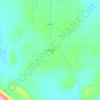
名称:Rock Springs地形图、海拔、地势。
地点:Rock Springs, Pope County, Arkansas, 72843, United States (35.41008 -92.99517 35.45008 -92.95517)
平均海拔:218 米
最低海拔:178 米
最高海拔:352 米
其他地形图
点击地图以查看其地形、其海拔和其地势。
Dover
United States > Arkansas > Pope County
The mild hills historically supported oak-hickory forest or oak-hickory-pine forest. Elevation changes and soil types make the Arkansas Valley Hills largely unsuitable for row agriculture. Instead, forest has been cleared for pastureland, poultry farming or ranching. Logging remains an important land use where…
平均海拔:164 米