
Baglung地形图
点击地图以显示海拔。
Baglung
Baglung enjoys warm summers and mild winters. Annual average temperatures range from a maximum of 26.6 °C (79.9 °F) and a minimum of 19.1 °C (66.4 °F). Highs above 35 °C (95 °F) and lows below 0 °C (32 °F) are rare. The average annual rainfall recorded is 1,060.9 mm (41.77 in) in 1982. Rainfall is heavily affected by the monsoon and most of it occurs during the months of June through September. Rest of the year is mostly dry and sunny. Snowfall is extremely rare in the city core, however, higher elevations within the city limits see occasional snow during the winter months. Due to large topographic variation climate ranging from hot subtropical to temperate montane climate can be experienced within the city limits.
关于这张地图
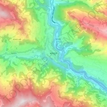
名称:Baglung地形图、海拔、地势。
地点:Baglung, Gandaki Province, Nepal (28.22511 83.56299 28.30511 83.64299)
平均海拔:1,358 米
最低海拔:712 米
最高海拔:2,288 米
其他地形图
点击地图以查看其地形、其海拔和其地势。