
Silliman Beach地形图
点击地图以显示海拔。
关于这张地图
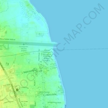
名称:Silliman Beach地形图、海拔、地势。
平均海拔:5 米
最低海拔:0 米
最高海拔:18 米
其他地形图
点击地图以查看其地形、其海拔和其地势。
Dumaguete
Philippines > Negros Oriental > Dumaguete
As a coastal city, it is bounded on the east by the Bohol Sea and the Tañon Strait, serving as a natural border of southeastern Negros Island Region to the neighboring Central Visayas. The city's topography is generally flat from two to six kilometers from the shoreline. It slopes gently upwards to the…
平均海拔:167 米