
Chicopee地形图
互动地图
点击地图以显示海拔。
Chicopee
Willimansett, and portions of the Center and Falls are on low land, with Aldenville, Fairview, Westover, and the Burnett Road neighborhoods on an elevated plateau. At 288 feet, the highest elevation in the city is on Old Lyman Road, in the Fairview section.
关于这张地图
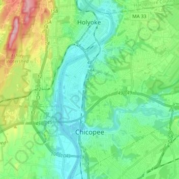
名称:Chicopee地形图、海拔、地势。
地点:Chicopee, Hampden County, Massachusetts, United States (42.12377 -72.62863 42.21873 -72.51391)
平均海拔:67 米
最低海拔:11 米
最高海拔:227 米
其他地形图
点击地图以查看其地形、其海拔和其地势。