
Monticello地形图
互动地图
点击地图以显示海拔。
Monticello
According to the United States Census Bureau, the city has a total area of 8.94 square miles (23.15 km2), all land. The city's latitude is 45.305 degrees North and its longitude is 93.793 degrees West. Its elevation is 922 feet. Monticello is in the Central time zone.
关于这张地图
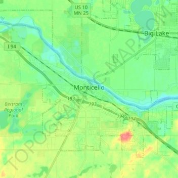
名称:Monticello地形图、海拔、地势。
地点:Monticello, Wright County, Minnesota, United States (45.27053 -93.86106 45.33840 -93.73503)
平均海拔:289 米
最低海拔:270 米
最高海拔:327 米