Village of Alliance地形图
互动地图
点击地图以显示海拔。
关于这张地图
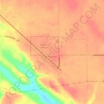
名称:Village of Alliance地形图、海拔、地势。
地点:Village of Alliance, 艾伯塔省, T0B 0A0, 加拿大 (52.43029 -111.79236 52.43915 -111.78040)
平均海拔:709 米
最低海拔:661 米
最高海拔:725 米

点击地图以显示海拔。
名称:Village of Alliance地形图、海拔、地势。
地点:Village of Alliance, 艾伯塔省, T0B 0A0, 加拿大 (52.43029 -111.79236 52.43915 -111.78040)
平均海拔:709 米
最低海拔:661 米
最高海拔:725 米