
Boston地形图
互动地图
点击地图以显示海拔。
Boston
Boston has an area of 89.63 sq mi (232.1 km2)—48.4 sq mi (125.4 km2) (54%) of land and41.2 sq mi (106.7 km2) (46%) of water. The city's official elevation, as measured at Logan International Airport, is 19 ft (5.8 m) above sea level. The highest point in Boston is Bellevue Hill at 330 ft (100 m) above sea level, and the lowest point is at sea level. Boston is situated on Boston Harbor, an arm of Massachusetts Bay, itself an arm of the Atlantic Ocean.
关于这张地图
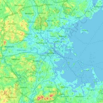
名称:Boston地形图、海拔、地势。
地点:Boston, Suffolk County, Massachusetts, 02102, United States (42.20025 -71.21829 42.52025 -70.89829)
平均海拔:26 米
最低海拔:-5 米
最高海拔:189 米
其他地形图
点击地图以查看其地形、其海拔和其地势。