点击地图以显示海拔。
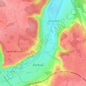
名称:La Cavée Rouge地形图、海拔、地势。
地点:La Cavée Rouge, Évreux, Eure, Normandie, France métropolitaine, 27000, France (49.01698 1.13460 49.05698 1.17460)
平均海拔:104 米
最低海拔:53 米
最高海拔:143 米
点击地图以查看其地形、其海拔和其地势。
France > Normandie > Eure > Évreux
平均海拔:118 米