Villa del Río地形图
点击地图以显示海拔。
关于这张地图
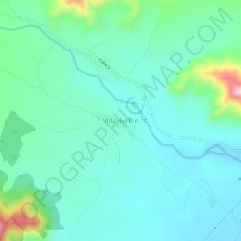
名称:Villa del Río地形图、海拔、地势。
地点:Villa del Río, San Juan del Cesar, La Guajira, Colombia (10.79144 -73.07119 10.83144 -73.03119)
平均海拔:308 米
最低海拔:246 米
最高海拔:554 米

点击地图以显示海拔。
名称:Villa del Río地形图、海拔、地势。
地点:Villa del Río, San Juan del Cesar, La Guajira, Colombia (10.79144 -73.07119 10.83144 -73.03119)
平均海拔:308 米
最低海拔:246 米
最高海拔:554 米