
Málaga地形图
点击地图以显示海拔。
Málaga
Like many of the military fortifications that were constructed in Islamic Spain, the Alcazaba of Málaga featured a quadrangular plan. It was protected by an outer and inner wall, both supported by rectangular towers, between which a covered walkway led up the slope to the Gibralfaro (this was the only exchange between the two sites). Due to its rough and awkward hillside topography, corridors throughout the site provided a means of communications for administrative and defensive operations, also affording privacy to the palatial residential quarters.
关于这张地图
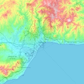
名称:Málaga地形图、海拔、地势。
地点:Málaga, Málaga-Costa del Sol, Malaga, Andalusia, 29008, Spain (36.56130 -4.58164 36.88130 -4.26164)
平均海拔:215 米
最低海拔:-1 米
最高海拔:1,019 米
其他地形图
点击地图以查看其地形、其海拔和其地势。